- Fragmentation of forested corridor complexes around Kaziranga National Park is causing wildlife to be concentrated in only secure areas of the protected area, a satellite-data based study has said.
- These concentrations may impact the behaviour and health of the species in the near future, authors warn.
- The mapping reveals that these corridor complexes of Kaziranga which offer passages for the movement of animals are not secured patches of connected forests but are mostly areas with multiple usage such as agriculture, mining, and settlements.
- There is no buffer zone in the park and animals historically have used the adjoining forests and highlands as refuge to escape the onslaught of seasonal floods. Connectivity between the protected area and such refuges holds the key to long-term conservation of the national park.
Satellite imageries of land use and land cover patterns in the corridor complexes around Kaziranga National Park (KNP), a World Heritage Site in Assam, show fragmentation of forests is forcing wildlife to be hemmed in, in secure areas only. These concentrations may influence the behaviour and health of the species in the near future, authors warn.
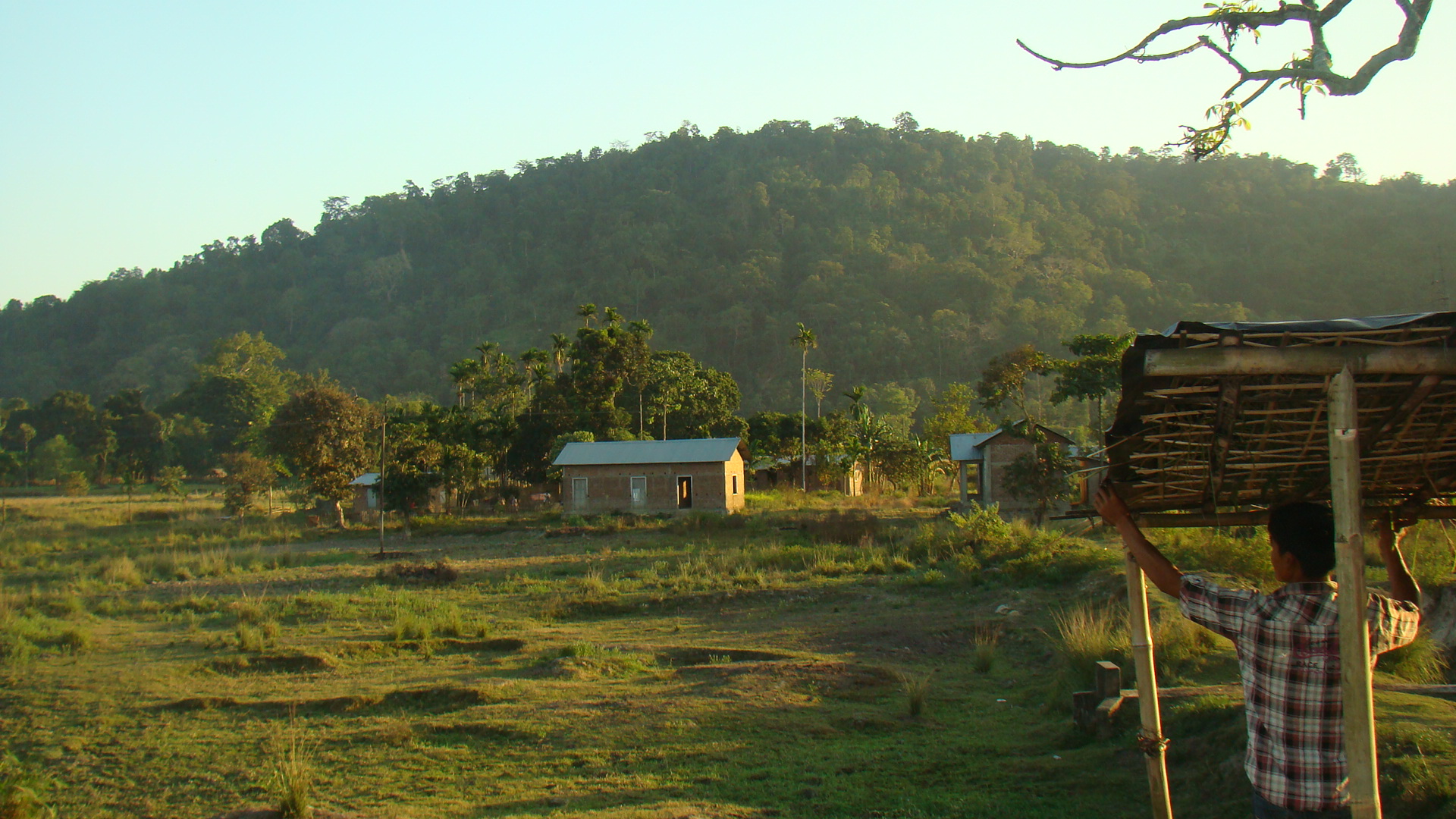
The 880 sq. km KNP, with a core forest area of 430 sq. km, is surrounded by the Brahmaputra on the north and the hills of Karbi Anglong in the south. Apart from being the world’s major stronghold of the one-horned rhino, Kaziranga is home to several globally threatened animal species like the tiger, Asiatic elephant, wild water buffalo, gaur, sambar deer, hog deer, and the hoolock gibbon.
There is no buffer zone in the park and animals historically have used the adjoining forests and highlands as a refuge from time to time to escape the onslaught of seasonal floods. The busy National Highway-37 bisects the once-contiguous Kaziranga landscape into two discrete regions: the floodplains of the protected area on its north and the Karbi Anglong hills on the south.
The study uses high-resolution satellite images for 2002 and 2013 and extensive field survey methods for documenting the pattern of the existing land use/land cover of the corridor complexes. Camera trap was used to track wild animals within the most possible locations in the corridors. Further, face-to-face interactions with elderly villagers residing closest to the wildlife corridors helped document the perceptions of the local people.
The analysis revealed a spontaneous decrease in core forest from 1176.69 square km in 2002 to 748.28 sq km in 2013. Loss of secured habitats in the surrounding areas may have driven the wildlife into the safer and rich habitats of Kaziranga National Park, the authors said.
“The unusual increase and concentration of these animals in a single protected area with limited space and connectivity could be harmful in the long run. The much-trumpeted conservation success of Kaziranga due to the increasing number of rhinos, elephants, and tigers could be a dangerous indicator,” the authors write in the study.
There are nine prominent tracts that are used by the animals for their movement to adjacent habitats and in many portions, both humans and wildlife use the same areas. This study has examined five corridor complexes that include the nine tracts. In 2019, a government constituted a committee, comprising members of the Assam forest department, also delineated nine major corridors connecting KNP to the areas to the south; most of those also formed a part of the corridor complexes considered under this present study completed during 2015–2016.

According to study author G. Areendran, Director, Indira Gandhi Conservation Monitoring Centre (IGCMC) and Information Technology, WWF India the satellite mapping’s objective was to address the complex issues of increasing wildlife, human population, and developments for better conservation management of the Park. “This exercise also helped us define forest fragmentation to better emphasise the threat to the existing biodiversity of the area,” Areendran told Mongabay-India.
There was a drastic increase in the areas covered by degraded forest from 7.8 sq. km in 2002 to 183.3 sq. km in 2013. The area covered by grasslands has decreased through the years from 492.6 sq. km in 2002 to 322.9 sq. km in 2013. The shrinkage in grassland has happened due to reasons such as degradation of habitat, fragmentation, overgrazing, etc.
Sonali Ghosh a senior Indian Forest Service officer with 20 years of experience of which 14 years were in Assam, and who was not associated with the analysis, remarked that the changes in land use pattern are “notable” with clear increase/decrease in certain land use categories due to human activities.
“What would have been interesting to also note and corroborate would be the landholding pattern in these corridor areas since most of it would be under private ownership. Conservation and management implications would be to suggest whether there is a possibility of incentivisation (payment for ecosystem services)/subsidies to private landowners to keep the land use animal friendly. Alternatively, is there a need to come up with stringent legal mechanisms to ensure landscape connectivity,” Ghosh told Mongabay-India.
The authors recommend measures such as identification and notification of eco-sensitive zones, promotion of eco-tourism/homestead tourism for the benefit of the fringe villages, construction of underpasses at strategic points across the highway, preparation of flood susceptibility map for the corridor complexes, and developing community-based conservation program based on indigenous knowledge to facilitate the unhindered movement of the animals.

Corridors are areas of multiple use
The five corridor complexes identified by WWF (that includes nine of the tracts) for the study are – Amguri corridor complex, Mongkrakjuri-Kanchanjuri corridor complex, Haldibari corridor complex, Panbari corridor complex and Kaziranga-Burachapori river corridor.
The mapping reveals that these corridor complexes of Kaziranga which offer passages for the movement of animals are not secured patches of connected forests but are mostly areas with multiple use. For example, of the five complexes considered in the satellite image analysis, the Kaziranga-Burachapori river corridor complex is the largest and covers about 655 sq km.
This complex is also the most disturbed as only nine percent area is covered by dense forest and three percent each by open forest, tea plantation, and by grasslands.
A large area of this corridor complex is under human activity; about 17 percent area is covered by agriculture, 3.8 percent by built-up area, and degraded land and mining area cover two percent of the complex. A large number of settlements, reflected by four percent of built-up land, sit on the complex.
“Non-functionality of corridors can deter animals from using those stretches safely, leading to the concentration of individual species. The forests of Kaziranga and Karbi Anglong have been historically connected patches that wildlife could easily occupy and move about. With time, there has been a loss of secured forests and increase in the number of barriers to the movement of wildlife and an increase in the potential threats to wildlife beyond the protected area,” said study co-author Amit Sharma, National Lead Rhino Conservation, WWF India.
All these may have forced the animals to mostly stay concentrated within the secured protected area and move out only in times of floods or other causes. In the long run, these concentrations can lead to competition for space and food. “These may get reflected in the behaviour and health of the various species in the near future,” said Sharma.
Corridors around a highway
The NH 37 “cutting across these major corridors leads to a barrier effect” for the wild animals with increasing traffic pushing them on edge. Over the last decade, road-side dhabas, hotels, residential complexes, and commercial establishments have sprung up along the gradually widening highway.
According to the corridor committee report, wildlife corridors are primarily of two types, functional and structural corridors. Functional corridors are the areas where there is a recorded movement of species. Structural corridors are strips of forested areas of varied forest cover and habitat quality and structurally connect the otherwise fragmented blocks of the landscape.
There are several stretches of functional corridors along NH-37, including the nine corridors cited by the committee, which emphasised that structural corridors should be made free of all human-induced disturbances except for the forestry and wildlife management practices as these are the primary paths of seasonal movements and dispersal of animals.

The highway which is now known as NH 37 has been the lifeline of the people of this region since the days of the Ahom kings. The highway has been there “even prior to the declaration of the Kaziranga Reserve Forest in 1908” but the population was then “very sparse” notes a 2014 KNP report. But as the population swelled, tourism flourished and other development activities in the area took off, the area on either the sides of the NH 37, gradually opened up to accommodate the activities; it eventually led to splintered forest cover, resulting in loss of natural wild habitat and wildlife corridors.
Varun R. Goswami Trustee and Senior Scientist, Conservation Initiatives, who is not associated with the study, told Mongabay-India that fragmentation of corridors can increase the risk faced by wildlife when they move, and can impede such movement altogether. It is thus a serious concern that must be addressed, he said.
“KNP owes its incredible productivity to the floods of the Brahmaputra that periodically recharge wildlife habitats within the park. But what this also means is that KNP’s wildlife needs to be able to find refuge elsewhere when the park is inundated by the Brahmaputra. The hills of Karbi Anglong and other refuges have played a critically important role in this regard, and connectivity between KNP and such refuges holds the key to the long-term conservation of KNP,” he said.
“This study provides an important perspective on how the landscape is changing and can be valuable in helping plan future strategies and policy that work towards minimising further disturbance that can negatively impact wildlife and disrupt their movement in and out of KNP,” Goswami told Mongabay-India.
Banner image: The speeding traffic on NH 37, expansion of human activities including settlements, stone quarries in the hill slopes of Ruthe Pahar, and agricultural practices including monoculture plantation in and around the Mongkrakjuri-Kanchanjuri Corridor are major threats. Photo by Amit Sharma.


