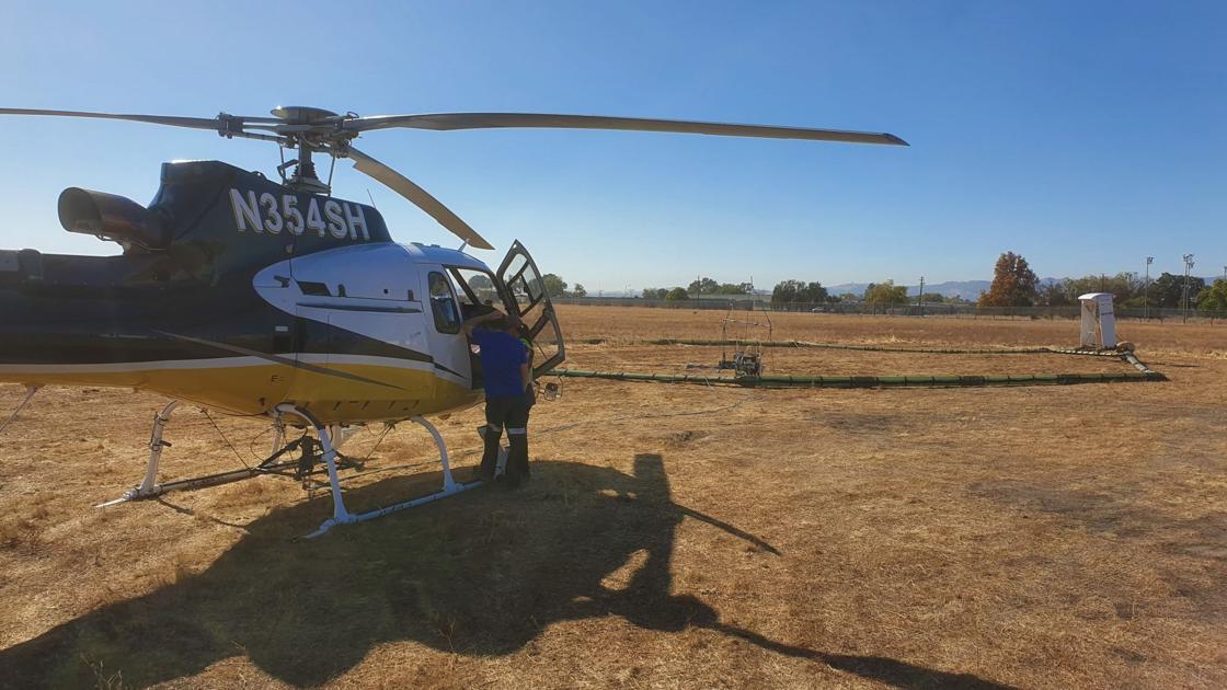

A diagram shows how an aerial electromagnetic method survey can provide images of subsurface conditions.
The technology was initially developed in World War II to detect enemy submarines, but it was subsequently adopted for use in locating minerals and oil.
“It’s the technology they used to use for mining, but with the Sustainable Groundwater Management Act, it’s become in demand for [groundwater mapping],” Young said.
Once the resulting images have been analyzed, they will be combined with water well data and information about the area’s geology to produce a three-dimensional map of the bedrock and the coarse sands and gravels and fine materials like silts and clays that make up the Santa Ynez River Valley Groundwater Basin aquifers.
The ultimate goal is to develop a groundwater sustainability plan to assure the basin will not be overdrafted — drawn down so low that it can’t provide the water supplies needed in the future and potentially sustain saltwater intrusion.

A graph compares the exposure levels of an aerial electromagnetic method survey, black line, with typical household appliances, black dots, and the general public’s average exposure, blue line, and occupational average exposure, yellow line.
The Santa Ynez River drainage area covers about 900 square miles, and the Santa Ynez River Valley Groundwater Basin extends from a point several miles east of Cachuma Lake along the riverbed to Vandenberg Air Force Base.
Multiple cities, services districts, farmers and others with wells drawing from the basin have a stake in its water.
The Sustainable Groundwater Management Act — known by the acronym SGMA, pronounced “Sigma” — mandates the formation of sustainability agencies to manage the state’s groundwater basins.
Because of the Santa Ynez River Valley Groundwater Basin’s size and the multiple jurisdictions involved, three groundwater management agencies — the Eastern, Central and Western — were formed to develop sustainability plans for their areas.


