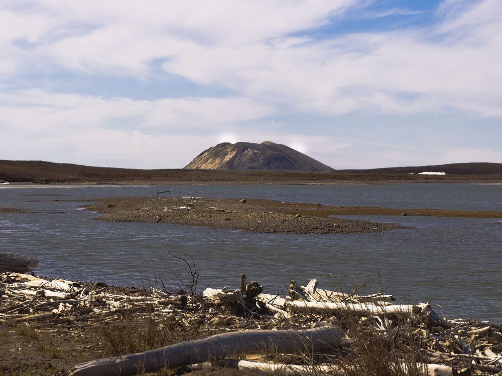
Article content continued
“They’re basically just giant ice cubes inside,” Wolfe said.

Many of Canada’s pingos were identified and mapped in the 1970s by renowned Arctic researcher J. Ross Mackay of the University of British Columbia. Early researchers used black-and-white air photos to identify the features and plot them on maps by hand.
“The data they had were quite poor. You can be sure that if they identified a pingo, they were correct. But now when we put them on a digital map they can easily be off by a kilometre or more,” Wolfe said. “They might have placed it in the middle of the water or on top of another pingo. With satellite imagery, we can pinpoint it within 50 centimetres on the ground and within 20 centimetres vertically.”
Last year, when Wolfe was unable to travel for his normal field research in the Western Arctic because of an injury, and again this year when he was grounded because of the COVID-19 pandemic, he decided to use his downtime to try to map pingos more accurately. He used high-resolution digital imagery of the Arctic — and Google Earth — to scour the Lake Erie-sized area around Tuktoyaktuk where pingos are found.
When he was finished, he’d identified 1,000 new pingos, nearly doubling Canada’s pingo population to 2,160. He even identified five and possibly six new pingos within the boundaries of Pingo Canadian Landmark, which formally only recognizes eight pingos.

But Wolfe’s pingo map isn’t just for bragging rights. Pingos are key indicators of climate change and the state of the permafrost that underlies them. About five per cent of the pingos identified in the 1970s have been lost to coastal erosion and Wolfe has identified about another five per cent that have collapsed because their ice cores melted away.


