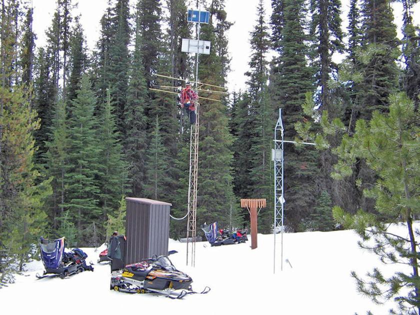
WESTERN TREASURE VALLEY — Some years the state of Idaho sees more snow than it knows what to do with, like in 2017. Other years, not so much. To get an idea of what the winter snow season has in store for our area, the Natural Resources Conservation Service’s Idaho Snow Survey has 120 sites set up statewide and into parts of Wyoming to monitor weather conditions and how much snow actually falls to let farmers and members of the public know what to expect in terms of water availability for the coming year.
To gain a better understanding about what this entails, the newspaper reached out to Mark Robertson, a Hydrologist for the Idaho Snow Survey who is based in Boise. Robertson is a Snow Telemetry (“SNOTEL”) data manager for the Boise, Salmon, Lost, Wood and Payette Rivers.
“The vast majority of these sites are in remote areas, and the days spent outside doing site visits, summer maintenance, and the snow surveys themselves are great perks,” wrote Robertson.
Robertson said he got into this field as a result of his interaction with a snow expert when he was in college.
“My graduate advisor at Boise State University was HP Marshall, who is our own local legend in the snow science world, with many ongoing projects with NASA, the Army Corps of Engineers, Idaho Power, and others,” wrote Robertson. “Through him and my graduate school work, being part of a team designing a new radar sensor for snow properties, I met most of the Idaho Snow Survey staff. Although it was a few years before there was an opportunity, I applied as soon as a position opened.”
Prior to working with the survey, Robertson worked for the U.S. Department of Agriculture’s Agricultural Research Service and participated in developing a snowpack density model which is used in basin scale aerial snow depth measurements.
“Both the snowpack model and aerial depth measurements rely on measurements of snowpack properties on the ground for guidance, such as the SNOTEL sites that are maintained by the National Resources Conservation Service (NRCS) which the Idaho Snow Survey is a part of. We applied the model mainly in California, and quickly realized that the density, reliability, and quality of measurement sites that the Idaho Snow Survey maintains, such as in the Payette basin, are not standard across the West.”
In addition to maintaining sites along the Payette River basin, Robertson also edits and maintains hourly data each site produces. The data helps officials when making water supply forecasts.
“Although the measurement equipment is well maintained, the nature of hourly measurements of snow and limitations of the sensors themselves require human skill on occasion for guidance. The data we produce helps water managers at Lake Cascade, and reservoirs across the state, plan and store for agricultural use.”
So, how are things looking for the 2020-21 snow season? Robertson says that’s still up in the air.
“We rely on long term forecasts produced by NOAA. The La Niña conditions suggest higher chances for a relative cool and wet winter for the Pacific Northwest, but it’s important to note a few things. First, La Niña conditions lead to cool and wet winters in the Pacific Northwest about half the time.”
Robertson noted Idaho’s geography plays into the forecast, with Southern Idaho often being on the edge of cooler, wetter conditions from the Pacific Northwest, becoming warm and dry farther south.
“A good snow year is far from certain – but we will keep our fingers crossed!”
Robertson praised the Snow Survey, giving the organization a review that many businesses owners dream of getting on Glassdoor.
“The quality and expertise that Idaho Snow Survey maintains is exceptional, and I’m proud to be a part of this program.”


